Monday, July 21, 2014

Thanks to everyone for your comments!!

I would like to thank everyone for following me on this amazing journey. I love reading your comments and words of encouragement. Please keep them coming it inspires me to remain motivated to push myself physically and mentally. 


I would also like to say that this past weekend a wonderful person passed away. His name was Ryan Corkran. He was my big brother in our fraternaty TKE at Columbus State University. He was a loving, caring and hilarious person. I loved him dearly. His celebration of life was today and I was not able to be there. He was a wonderful person and he will be missed. My thoughts are with his family, his wife and children. 

Rest in peace among the clouds Brother, you will be missed. 


Monday, July 14, 2014

Day 10 through 17

Day 10: Zero day (rest day) in Greenville
Eat, sleep, stretch, meditate 

This is Moose Head lake in Greenville. 


Day 11: Zero day in Greenville
Eat, sleep, stretch, meditate 

Day 12:  9.0 miles

Hitched a ride back to the trail and started hiking about 11am. Had to ford one river. It was an easy 9 miles. 


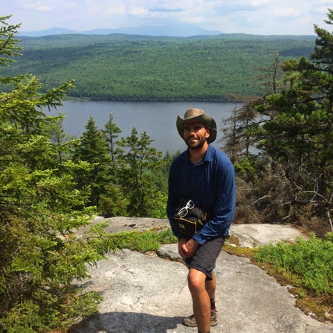
Here's a picture of me at the office.


Day 13: 22.0 miles - my longest day yet

Started at 7:30 am and finished at 8pm. I went over 2 mountains, Moxie Bald and Pleasant Pond mountain. They were about 2,400 ft high. I forded 3 rivers and went over 2 mountains!

One of the rivers I forded had a rope to help get across it. 


Here's another river I crossed. 


Day 14: 19.7 miles

This was a great day of hiking. I had to cross the Kennebec River. This river is controlled by a dam so the water levels and current will change rapidly. So, there was a guy in a canoe that will ferry you across with your pack. Finally!! Crossed a river and didn't get wet! The lean-to I stayed at was right next to a beautiful pond and I got some great pictures of the sunset. 


Day 15:  17.9 miles

Very difficult day, another 13 hour day if hiking. Went over 4 peaks with the highest being about 4,100 ft. Coming down was hard because it was pure bouldering. No trail just huge boulders. Incredible views for the top. It was very powerful. 


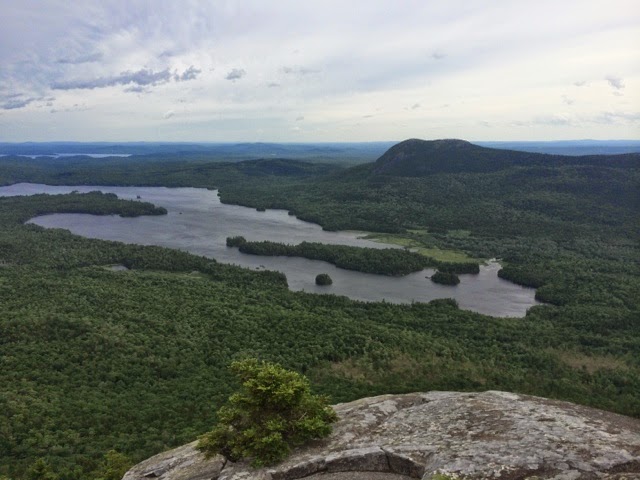
This is the view from Little Bigelow's mountain. The mountain in the distance is Bigelow's mountain, which I still had to cross that day. 


Day 16: 5 miles

Here is a view of Bigelow mountain as I was coming down the other side. 


Made it to the road and hitched to Stratton. Got a room and a shower and then it was time to eat an resupply. When I was coming down from the mountain my knee was giving me trouble so I decided to take a day off here. Only about 3 places to eat here but he food is good, although the resupply was expensive. 

Day 17: Zero day

Eat, sleep, stretch, meditate. 

I'm heading out in the morning around 8:30. I will post more in about 5 days. 


Sunday, July 13, 2014

How we navigate on the trail

The Appalachian Trail is marked by white blazes like this one. 


A double white blaze usually means a sharp turn is coming up. 


 A blue blaze means this is a side trail, scenic trail or bypass trail. 


This is an example. 


Enjoy. 


More photos: Katadin & 100 mile wilderness

Katadin


This area to the right is called "Knifes Edge". It looks scary. We didn't hike that, not cause we were scared (maybe a little) but because it's technically not part of the AT.


The 100 mile wilderness is exactly what it means. It is a vast area of nearly untouched land with no towns. This area is home to many species and habitats. 


This is a view of mount Katadin from the 100 mile wilderness. 


They call this a "pond", you can also see Katadin in the background. 


Some of these areas look pre-historic and it seems like a dinosaur could just walk right out at any time. 


Even had some time to do some yoga. I know it's not prefect Mel, but it's progress not perfection.


Hope you like 'em!!


I miss you Mel!! Love you!


Monday, July 7, 2014

Greetings from the AT everyone!

I finished the 100 mile wilderness yesterday and was greeted by my cousin Moz and his dog Rocky who drove me to town to get a room. He also met me with plenty of food and drinks! What a lifesaver, thanks Moz! 

 So here's the run down people. I will be posting about once per week when I have down time and/or phone service. So if you don't see a post for awhile this is why. Don't get worried.

So here's what's been going on the past week. Made it to Maine on the 25th and hung out with Moz and Allysa at their beautiful home in Norway, Maine. 


Headed to Baxter State Park Friday afternoon and spent the night. Saturday Cyrus, Moz and myself climbed mount Katadin. It was a total of 4,162 vertical feet! It took about 7 hours total to go up and down.


Day 1: Mt. Katahdin - 5.2 miles (10.4 miles total up and down)

Day 2: Baxter State Park - 13.4 miles (Bugs, bugs, bugs!! blister started)

Day 3: Entering the 100 mile wilderness - 11.5 miles


Day 4: 8.1 miles, rest up and let my feet heal. I was hiking with a couple named Chad and Shelly. We found a sand beach and all took a hiker bath while washing our clothes at the same time. On the way back to camp I saw my first black bear. He scared away easily and we didn't see them again. 


Day5: 21.5 miles!!! 
Chad and Shelly started to slow down and they told me to go on ahead. I started booking it through the rain. I hiked about 7 miles in my crocs, due to my feet hurting from blisters on my heals.  While hiking through the rain I came upon a beautiful female moose drinking from a lake. It was very powerful. What a majestic animal. She saw me right away and we just stared at each other for sometime. 


Day 6: 11.7 more rain and spirits were low. Missing friends and family. Here are some built in steps that you will see on the trail sometimes. 


Day 7: 17.1 miles. I hiked from 8:30am to 7:45pm. Climbed White Cap mountain and Chair Back mountain. I also crossed a river that was 3.5 ft deep and about 150 feet across. 


Day 8: 10.9 miles. It was a very cold and windy day. The temperature was around 52 but with the wind chill it could have been 40 or so. 


Day 9: 15.1 miles end of 100 mile wilderness!!!! 

It makes for such a long day when you know you will see family and get to eat some good food. I had 5 river crossing and at the first one there was a dead moose. 


I got lost twice and was hurting all over and just wanted to get out of there. Finally made it close to the end and was met on the trail by Moz and Rocky with food and drinks! Thanks again Moz, for everything. Love you cuz. 


I miss all my family and friends back home, everyone from AFDC, Alumni and caduceus. Talk you soon.